Advertising
West Tatras West Tatras West Tatras


Hiking, Trip to surroundings
Around the village Hrob

Length: 13 km
Dificulty: medium
Circle: YES, Marking: partialy marked

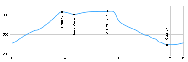
Trail trip begins at the crossroads by the bus station in the village Hrob and then after the red mark leads north under the hill Bouřňák and then to the cottage at its peak. Then, the route continues following yellow sign to Nové Město and then at the top of the hill Vrch tří pánů. From the top of the peak Vrch tří pánů the trail continues to the way Domaslavické valley and through Krizanov back to the village Hrob.


 Dist.   Location   Elevation   Marking   Description 
 0,0 
 Hrob 
 352 m n.m.        
 3,7 
 Bouřňák 
 792 m n.m.        
 4,8 
 Nové Město 
 831 m n.m.          
 7,2 
 The hill - Vrch tří pánů 
 847 m n.m.        
 11,6 
 Křižanov 
 345 m n.m.        
 13,0 
 Hrob 
 352 m n.m.        


 Historical monuments municipalities - the foundations of wrecked Protestant church, the Catholic church of St. Barbara, Evangelical Church of the Resurrection, Baroque statues on The market square.
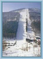
 Ski resort. From the top of Bouřňák lead towards to the Mikulov 4 downhill slopes, one route towards to the settlement Hrob.
 On the peak Vrch tří pánů grew three wind power and significantly streamline the Panorama ridge of mountains

Hiking, Trip to surroundings - Around the village Hrob


Photos of the route

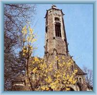
St.Barbora´s church in Hrob
Sight of mountain Bouřňák from Mikulov
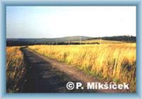
Way from mountain Bouřňák
Valley under the mountain Bouřňák


Back

  Accommodation Mikulov
  Accommodation Teplice
  Accommodation Kovářská
  Accommodation Ore Mountains
Catalogue of accommodation
 
TOPlist